
Thanks For The Visit !

www.farmboyzimsflightsims.com
FBZFS
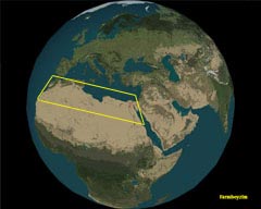
North Africa
What comes to mind when I say �North Africa�? How about the words �Hot, Dry, and flat�? Well, you are about eighty percent right. So why take a �Green Flight� in this barren region? You may be thinking that old FBZ has been out in his fields too long and the sun has dried up his brain! OK, that�s certainly a possibility, but the fact is, North Africa can easily offer up hours upon hours of very diverse flying and some pretty cool sites to see along the way as well. Since this is a �Green Flight�, we will also take a look at what�s going on environmentally in the area as well. Although we are flying in a �virtual environment�, and this environment is free of pollution and other hazards, I don�t think it would hurt to know what�s going on in the �real World� as well!
North Africa is made up of the following countries; Morocco, Algeria, Tunisia, Libya, and Egypt. The continent of Africa is very large, and consists of many individual nations. I�m going to break it down into regions, giving you a general idea where to start and a few things to look for along the way.
This area is also known as the Maghreb, and is an area that is extremely diverse and also has a long, interesting history. This region has been no stranger to invaders over the centuries. Many areas, such as the countries of Morocco and Algeria have been influenced through centuries of invasion and occupation. It�s just a �stone�s throw� across the Straight of Gibraltar, to the continent of Europe, Spain in particular.
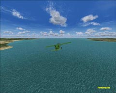
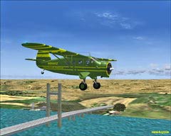
When flying in Morocco, a coastal run is a must! Not passing through the Straight of Gibraltar would be like not flying under the Golden Gate Bridge�virtually, of course! Seriously though, it is rather interesting to see just how close two entirely different continents can be, separated by a narrow stretch of water. A nice, medium length flight in a GA aircraft could be from Marrakech, another familiar city to some, north to Casablanca, a short hop to the capital Rabat, and then on up to fly the Straight of Gibraltar. This route will take you from an area that is just north of the Atlas Range, over to the Atlantic and up to the Mediterranean. All this in roughly 350 miles or so, as the crow (or pilot) flies!
If you decide to see what is on the other side of those mountains, you can take off out of Marrakech and fly southeast, up over the range and into the Sahara. Even in the simulator, you�ll find some breathtaking and pretty cool places to fly (not literally �cool� of course!). There�s a Terrain Mesh enhancement by Andreas Trawny. It includes the High Atlas, the cities of Agadir & Marrakech and northwestern parts of the Sahara Desert. Search for a file named atlas_mountains_srtm.zip. Toni Agramont created very nice freeware scenery for the Kingdom of Morocco, with Kasbahs and other monuments.
If you decide to see what is on the other side of those mountains, you can take off out of Marrakech and fly southeast, up over the range and into the Sahara. Even in the simulator, you�ll find some breathtaking and pretty cool places to fly (not literally �cool� of course!). There�s a Terrain Mesh enhancement by Andreas Trawny. It includes the High Atlas, the cities of Agadir & Marrakech and northwestern parts of the Sahara Desert. Search for a file named atlas_mountains_srtm.zip. Toni Agramont created very nice freeware scenery for the Kingdom of Morocco, with Kasbahs and other monuments.
North Africa
North Africa is made up of the following countries; Morocco, Algeria, Tunisia, Libya, and Egypt. The continent of Africa is very large, and made up of many individual nations. I�m going to break it down into regions, giving you a general idea where to start and a few things to look for along the way.
This area is also known as the Maghreb, and is an area that is extremely diverse and also has a long, interesting history. This region has been no stranger to invaders over the centuries. Many areas, such as the countries of Morocco and Algeria have been influenced through centuries of invasion and occupation. It�s just a �stone�s throw� across the Straight of Gibraltar, to the continent of Europe, Spain in particular.
The ties between the United States and Morocco date back to 1777, when American Merchant ships were coming under attack on the high seas. A sympathizer of the young country of America, US shipping was declared to be
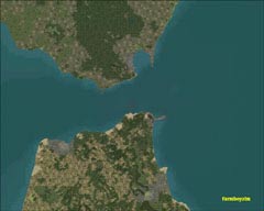
Straight of Gibraltar
N. Africa on the left, Europe on the right
under the protection of the Kingdom of Morocco while sailing in her waters. The ties of friendship between the two nations have remained since that time. As a matter of fact, Morocco was the first country to allow the US to establish a consulate on foreign soil. The country itself is a bit bigger than the state of California. Morocco controls part of the Straight of Gibraltar, to the north, which is the access point in and out of the Mediterranean. Stretching from Morocco to Tunisia in the east is a mountain range called the Atlas Mountains. This range separates the temperate and more livable coastal region of North Africa from the Sahara Desert. The majority of the population resides north of these mountains. Its capital is Rabat, but Morocco is home to a more familiar city, Casablanca, which is both the nation�s largest city and its main port.
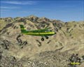
The Atlas Mountains
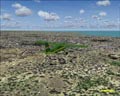
Morocco has four separate mountain ranges, valleys with rivers winding through them, long expanses of coastline, and of course, the already mentioned desert. Rivers that empty on the southern side of the Atlas range, form long green ribbons of oasis-like environments that stretches into the Sahara for short distances, until they dry up in the burning sands of the Sahara. It is hard to imagine that at one time, a VERY long time ago, the Sahara was not an arid expanse of land, but had an environment that could support abundant life. The ever changing Earth (and Man?) at work no less. As a matter of fact, the expansion of the Sahara further into the south is a reality, and is an environmental factor that is being studied intensely.
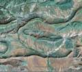
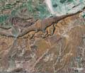
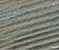
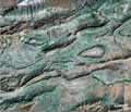
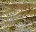
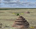
Here are a few shots from Google Earth of the Sahara. I like to call them the "Many Faces of the Sahara"... Note the elevations for the shots.
Here are a few shots from Google Earth of the Sahara. I like to call them the "Many Faces of the Sahara"... Note the elevations for the shots.
The Sahara Desert
17.43 Miles
25.09 Miles
10,738 feet
44,603 feet
24.99 Miles
11.64 Miles
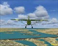
Just over the Atlas Mountains out of Morocco is the Sahara Desert
Although the borders between Morocco and its neighbor to the east are closed in the real world, feel free to enter the airspace of Algeria, the second largest country on the African continent. As you travel along the coastal areas, most of the terrain will be that of hills and some mountains. A small area of Algeria is fertile, but around 85% of the country is uninhabited desert. About the only people you are going to find roaming in the desert would be the nomadic Bedouin tribes that travel in search of grazing land for their livestock. I just had the thought, �Grazing land in the desert?�, as I wrote this. They must surely know all the �hot� spots to graze! Ooohhh! That hurt!
Algeria is the second largest country on the African continent. Algeria gained its independence from France, which took place in 1962. As you travel along the coastal areas, most of the terrain will be that of hills and some mountains. A small area of Algeria is fertile, but around 85% of the country is uninhabited desert. On the steppes of the High Atlas, gale force winds sometimes blow off the desert, creating a very dusty, choking environment. These winds are called �sirocco�, and are probably best avoided if you are in an aircraft. Algeria is about four times the size of Texas. So here�s a little something to ponder�If 85% of the country is desert, this works out to about three and a half Texas-sized sand boxes! Wow! Ninety-one percent of the population inhabits twelve percent of the land mass, and this is along the coast of the Mediterranean.
Algeria is the second largest country on the African continent. Algeria gained its independence from France, which took place in 1962. As you travel along the coastal areas, most of the terrain will be that of hills and some mountains. A small area of Algeria is fertile, but around 85% of the country is uninhabited desert. On the steppes of the High Atlas, gale force winds sometimes blow off the desert, creating a very dusty, choking environment. These winds are called �sirocco�, and are probably best avoided if you are in an aircraft. Algeria is about four times the size of Texas. So here�s a little something to ponder�If 85% of the country is desert, this works out to about three and a half Texas-sized sand boxes! Wow! Ninety-one percent of the population inhabits twelve percent of the land mass, and this is along the coast of the Mediterranean.
The highest point in Algeria can be found in the southern Sahara, and that would be Mount Tahat, which rises 9850 feet. It�s not that impressive in default MSFS land, but with the terrain mesh enhancement from Midouman N., for Algeria, things pop out at you with a bit more life. There are four files in total, dz_m01.zip through dz_m04.zip. Once again, most of the interesting flying will be found in and around the mountains and the coast, but do not neglect excursions into the desert for some navigation training! Not to many landmarks to fix on so you better hone up on map reading and make sure there are fresh batteries in your GPS, just in case! There is some nice photoreal scenery for DAAG, the airport in Algiers. You may want to pick up algeri.zip if you are not a big fan of photoreal scenery. This little package has scenery for Oran and Algier Harbors, as well as DAAG and DAOO airport scenery. Toni Agramont is the author of this freeware addon.
DAAG, Algiers, Algeria
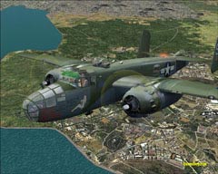
MAAM-SIM's "Briefing Time" over Tunisia
Wedged in between Algeria and Libya, is the country of Tunisia. The city of Carthage, in Tunisia was the birthplace of the great military leader Hannibal, who invaded Italy over the Alps with war elephants. Tunisia is now known for its beautiful coastline and tourism trade, and it is also the eastern end of the Atlas Mountains. There is little difference in terrain features between Tunisia and the country�s that
border it. On your coastal cruise, Carthage would be an ideal spot to stop for fuel, as the airport there can accommodate mostly all GA aircraft as well as Commercial jobs.
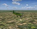
Libya is the next stop in our eastern journey across North Africa. Muammar Abu Minyar al-Gaddafi, Libya�s leader since a coup in 1969, has, in the past, been a thorn in quite a few people�s sides. In recent years, however, Libya is trying to change its �trouble-maker� reputation and become a respected member of the world community. Having deposits of oil that is highly regarded for its low sulfur content, making it a very clean burning fuel certainly helps the issue. While flying in the skies of Libya, you�re in for much of the same, considering that 90 percent of the country is desert, with most of the population living along the Mediterranean coast. The two points of interest here on a flight would be Tripoli and then on to Benghazi, to the east. Both of these cities are on the coast. From my explorations, Libya seems to have the flattest desert so far in this region, with a minimum of mountain ranges to break up the terrain. I could not find any terrain enhancements for this area, so if you know of any, let me know!
Libya is the next stop in our eastern journey across North Africa. Muammar Abu Minyar al-Gaddafi, Libya�s leader since a coup in 1969, has, in the past, been a thorn in quite a few people�s sides. In recent years, however, Libya is trying to change its �trouble-maker� reputation and become a respected member of the world community. Having deposits of oil that is highly regarded for its low sulfur content, making it a very clean burning fuel certainly helps the issue. While flying in the skies of Libya, you�re in for much of the same, considering that 90 percent of the country is desert, with most of the population living along the Mediterranean coast. The two points of interest here on a flight would be Tripoli and then on to Benghazi, to the east. Both of these cities are on the coast. From my explorations, Libya seems to have the flattest desert so far in this region, with a minimum of mountain ranges to break up the terrain. I could not find any terrain enhancements for this area, so if you know of any, let me know!
Last, but certainly not least, is a country that has intrigued me as a boy and years later, I would find myself studying this culture in Mortuary Science College. You may have guessed it�Egypt. In this North African nation, you not only have deserts, such as The Great Sand Sea (sounds appealing, eh?), but other avenues for aviation exploration abound in this country. Start in the north, on the coast of the Mediterranean Sea; fly out of El Alamein, where massive battles once raged during World War II. You won�t see any of the burned out hulls of tanks and bent artillery pieces, but as you look out upon the desert, it is not hard to imagine just how harsh of an experience fighting in this environment was for the soldiers of both sides.
Out of El Alamein
Head east out of El Alamein, to Alexandria, a truly �Wondrous� city! It is the second largest city in Egypt, and the country�s largest seaport, handling the majority of the import and export business for Egypt. Stepping back into the ancient past, Alexandria was founded by Alexander the Great, a Greek Macedonian King, around 331 B.C. I had stated it was a �wondrous� city and here�s why. Alexandria was once known for the �Lighthouse of Alexandria�, one of the seven wonders of the Ancient World. The Catacombs of Kom el Shoqafa, and the ancient Library of Alexandria, were all located here as well.
Port Said
From Alexandria there are a few options as to what direction to explore. I chose an eastern flight path, along the coast, with the Nile Delta on my starboard wing, and did a fly-by of Port Said. Along with its usual duties serving as an important gateway for products of Egypt, it is also a refueling station for the ships travelling the Suez Canal. I travelled down the canal, with the Sinai Peninsula off the port wing. The Sinai is an interesting plot of land itself, with a history. There are some nice mountains to cruise over if you want to proceed on into Israel or other parts of the Middle East. There�s a very neat little scenery add on for the Suez Canal, by the name of suezchannel.zip. The authors name was not plainly referenced in the read me file, but �winfriedorthmann� is referred to. Nonetheless, nice job and well worth adding it in if you want some realistic scenery for this area. After seeing this desert, I really looked forward to flying along some waterways, and seeing the effect that they have, as they slice through the desert. The main channel of the Suez Canal connects the Mediterranean Sea with the Red Sea and the Indian Ocean. The opening of the canal back in 1869 meant that overland travel was a thing of the past. Before the canal was built, this was one of the shortest ways to exchange goods between Europe and Asia. A wealth of information, both past and present is available on this man-made highway of water.
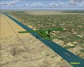
Starting the trip down the Suez Canal
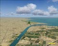
Busy waterway
South end of the canal
The city of Suez
Where the ships start their trip to the Med
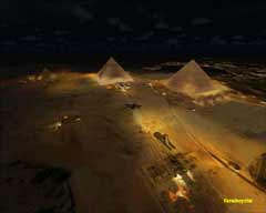
Once I reached the city of Suez at the south end of the canal, I decided to pay the Pharaohs a visit in Cairo. Landing at Cairo International, I decided that it was time for dinner (my wife called for me to come and eat!), but it was good timing, for the trip was approximately 450 miles. After eating dinner, (and helping to clean up by the way!), night had come to Cairo. The Pyramids (the virtual one�s in MSFS, just to remind you what world we�re talking about!) looked impressive that day but at night�absolutely beautiful and a must-see landmark at night!
I had flown some of these flights in both FS9 and FSX, and preferred, for the most part, flying the area in FS9. This is due to the fact that I have FS9 �tuned-up� like an old Hot Rod! Smokin�, if I do say so myself! But with FSX, I�m flying in a default world for the most part. However, as I flew over the Pyramids in FSX, I was treated to a beautifully realistic site, both in daylight and at night! Very nice upgrade in the scenery there gang! My compliments MS! I wanted to explore this ancient land more, so my next flight took me south, on the Nile, but not before I checked out the Ancient Pyramids!
I had flown some of these flights in both FS9 and FSX, and preferred, for the most part, flying the area in FS9. This is due to the fact that I have FS9 �tuned-up� like an old Hot Rod! Smokin�, if I do say so myself! But with FSX, I�m flying in a default world for the most part. However, as I flew over the Pyramids in FSX, I was treated to a beautifully realistic site, both in daylight and at night! Very nice upgrade in the scenery there gang! My compliments MS! I wanted to explore this ancient land more, so my next flight took me south, on the Nile, but not before I checked out the Ancient Pyramids!
Egyptian Air Force Base
Night over Cairo, Egypt
The Pyramids at Giza, FSX
Approaching the Pyramids
Worth the trip!
Ongoing exploration
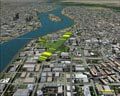
Neighboring Cairo
Cairo on the Nile
Pyramids at night, FS9
Top-down of Cairo, Egypt
Out of Cairo and on to the city of Luxor, the site of the ancient city of Thebes. A very interesting place to read about, but keep on flying! Nothing especially spectacular to see there in sim land! South of Luxor, continuing along the Nile, we come to the city of Aswan, which lies at the north end of Lake Nasser, which is a man-made reservoir. Some ancient sites had to be disassembled piece by piece, and reassembled in other locations due to the rising waters of the newly formed lake. This took place back in the 1960�s. One of the more notable and recognizable sites to be relocated was the Abu Simbel Temples of Ramses II and Nefertari. This was an incredible feat!
I found more freeware addons for Egypt than the other countries visited in this article. Among the files I found were upperegypt2.zip, featuring the Aswan Bridge, the dams at Lake Nasser, and some land class enhancements. One of the mesh enchantment files I also utilized for the region was middle_east_lie_srtm_mesh_part1, 2, and 3.zip (three files in all). Quick reminder here�you will probably have conflicts of some sort if you load more than
I found more freeware addons for Egypt than the other countries visited in this article. Among the files I found were upperegypt2.zip, featuring the Aswan Bridge, the dams at Lake Nasser, and some land class enhancements. One of the mesh enchantment files I also utilized for the region was middle_east_lie_srtm_mesh_part1, 2, and 3.zip (three files in all). Quick reminder here�you will probably have conflicts of some sort if you load more than
one mesh enhancement for a particular area. Scenery that I used included another freeware file by winfriedorthmann (that�s how the names listed as part of the email address), suezchannel.zip. This little package contains scenery for the Suez Canal, Port Said, and the city of Suez. This is a very nice enhancement for the region. Just do a search on any of the major flight sim sites in the �Scenery� category and see what else you can come up with.
My hats off to the folks that provided the great freeware models that I used for this adventure�
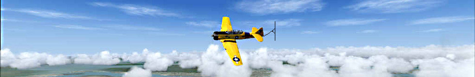
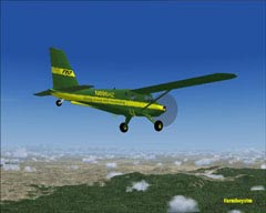
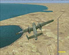
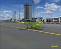
Brian Gladden�s FS 2004 Noorduyn, repaint by yours truly, Premier Aircraft Design�s DeHavilland DHC2- Mk III Turbo, with yet another paint job by me, and a beauty of a vintage aircraft by Bill and Lynn Lyons, the Travel Air Magic One, for both FS9 and FSX. That B-25 is courtesy of Mid-Atlantic Air Museum (MAAM-SIM) and is a payware product that is well worth its cost! Her name is �Briefing Time� and this particular aircraft saw action in the North African Campaign.
What I thought would be a rather mundane adventure, exploring the North African continent, turned out to be a very interesting and diverse flight. Now, it wouldn�t be a �Green Flight� if I didn�t comment on the environmental issues of the area. �Desertification�, the spreading of the desert, is the issue here that I would like to make a comment on. If you recall in my article on China, the Gobi Desert is also continuing to expand. The Sahara is constantly spreading as well. Heading up the list of culprits, are humans. Folks are clearing land of foliage and other ground cover for agricultural and developmental reasons, and without this �green buffer zone�, the desert continues to walk its walk. Better land management is only one course of action to take. Water Conservation, also is no longer an option, but a necessity in many regions. Only 2.5% of the planet's water is made up of freshwater supplies, 70% of which is locked into polar ice caps. Just 0.5% of the planet's freshwater supplies can be used by man. Imagine what the percentage of available water is in Africa!
No matter where in this big, beautiful world we live, we all share the same �Backyard�! If we�re not careful, there�s going to be more regions around this globe that will resemble the Sahara. Personally, I like to fly around with something other than endless, flat terrain to look at! I invite you to explore North Africa on your own, both virtually, and informational. There is loads of information regarding this area, of which Wikipedia was an invaluable source.
Thanks to FS Ground Environment Pro for making a wonderful enhancement for FS! I hope you enjoyed the article and I think you will find some very interesting flying in North Africa! Once again, the side note to these �Green Flights� is to make folks aware of some of the environmental situations that exist today around the globe. After all, are we not all sharing a unique perspective of the world from up on high? Take care and remember to fly GREEN!
Abu Simbel Temples
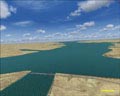
Aswan Dam
FS 2004 Noorduyn
Premier Aircraft Design�s DeHavilland DHC2- Mk III Turbo
Travel Air Magic One
MAAM-Sim's B-25
"Briefing Time"
"Briefing Time"
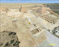
The "Really Old" Pyramids!
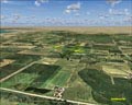
There is agriculture along the coast
DAAG
Lake Nassar
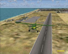
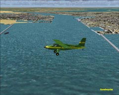
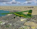
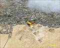
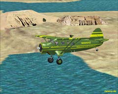
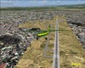
Casablanca, Morocco
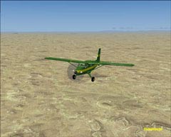
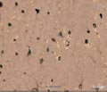
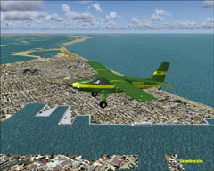
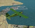
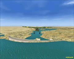
Dirt Strips, Casablanca
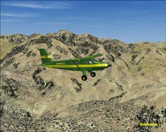
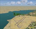
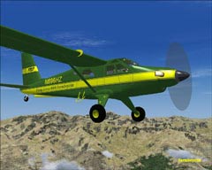
Marrakech , Morocco
The Atlas Mountains
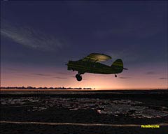
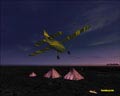
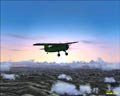
Sunset over the desert
The dams of Lake Nassar