
www.farmboyzimsflightsims.com
FBZFS

Thanks For The Visit !
FBZ's Fast Flight's
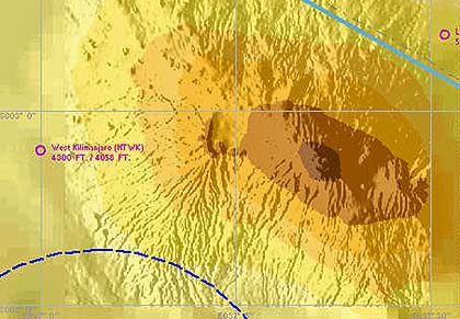
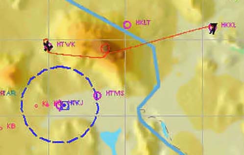
Mt. Kilimanjaro
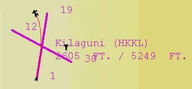
HKKL (Kilaguni) To HTWK (West Kilimanjaro)
Mt. Kilimanjaro
HKKL (Kilaguni) To HTWK (West Kilimanjaro)
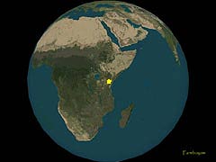
Get ready to breathe the thin air! We're going south on this FBZ Fast Flight, to the continent of Africa. To be more exact, Mt. Kilimanjaro. Let me clue you in a bit on the area...
Mount Kilimanjaro in 2004
Elevation: 5,895 metres (19,340 feet)
Location:Tanzania
Prominence: 5,885 m
Coordinates: 3�4'S, 37�21'E
Type: Stratovolcano
Last eruption: None in recorded history
First ascent: 1889 by Hans Meyer and Ludwig Purtscheller
Mount Kilimanjaro in 2004
Elevation: 5,895 metres (19,340 feet)
Location:Tanzania
Prominence: 5,885 m
Coordinates: 3�4'S, 37�21'E
Type: Stratovolcano
Last eruption: None in recorded history
First ascent: 1889 by Hans Meyer and Ludwig Purtscheller
Kilimanjaro includes the highest peak in Africa at 5,895m. It is a giant stratovolcano, not currently active, with fumaroles that emit gas in the crater on the main summit of Kibo. Scientists concluded in 2003 that molten lava is just 400 metres below the summit crater. Although new activity is not expected, there are fears the volcano may collapse, causing a major eruption similar to Mount St. Helens. Several collapses and landslides have occurred on Kibo in the past, one creating the area known as the western breach. Although there is no recorded history of eruptions, local legend speaks of activity around 170 years ago. The highest point is Uhuru Peak on the volcano Kibo, 5,895 metres. As the highest point in Africa, Uhuru Peak is one of the Seven Summits. Two other peaks are also extinct volcanoes: Mawenzi (5,149 metres), the third highest peak in Africa and Shira (3,962 m).
Current conditions at Kilimanjaro
While the volcano appears to be dormant on the inside, it is the events that are taking place on top of the mountain that are drawing global attention recently. The snow cap that has covered the top of the mountain for the past 11,700 years is rapidly disappearing. Over the past century, the ice cap volume has dropped by more than 80%. In, a study led by Ohio State University ice core paleoclimatologist Lonnie Thompson predicted that ice on top of Africa's tallest peak would be gone between 2015 and 2020. In March 2005, it was reported that the peak was now almost bare, for the first time in 11,000 years. A comparison of ice core records from Kilimanjaro suggests that conditions similar to those of today have not existed in the past 11,000 years. The loss of the Kilimanjaro ice fields will carry significant climatological and hydrological implications for local populations who depend on water from the ice fields during the dry seasons and monsoon failures.
As of January 2006, the Western Breach route has been closed by the Tanzanian government following a rockslide which killed four people at Arrow Glacier Camp. The rockslide is believed to have been caused by frost action in an area which is no longer permanently frozen.
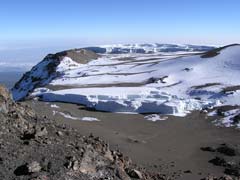
Actual Photo of the Peak
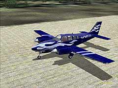
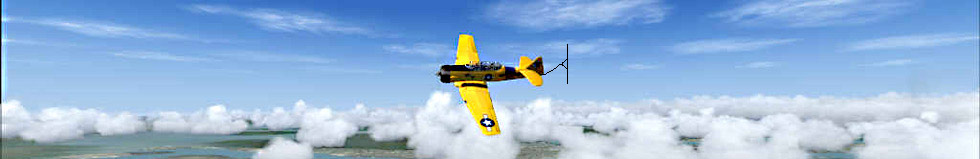
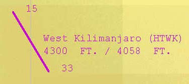
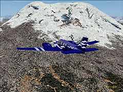
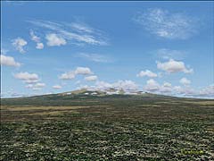
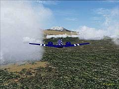
For the flight, I used a turbocharged Beechcraft Baron 58. Modifications were done by Brett Henderson and the repaint was done by Donnie Walker. It had the juice to get the altitude and speeds needed. The airfield where I took off from, HKKL is tucked into what looks like a bathtub type depression just a few miles east of Mt. Kilimanjaro. From here, I began my immediate climb to FL190, and headed west, toward the summit. The top of Kilimanjaro, Uhuru Peak, is obscured by clouds most of the time, but as you approach, the clouds start to part and there in front of you, rising up out of the flatlands that surround it, is Mt. Kilimanjaro. What a sight to see! These Flight Simulator images might be the only way to see what this giant looked like with ice and snow on the peaks, in the not so distant future. The land that surrounds the volcano is flat, with beautiful foothills at the base. You can see how the local population depends on the runoff from the volcano to help supply water to the surrounding area by the amount of lush green landscape that grows in the area. After flying around the peak once, I headed NE toward an airfield called HTWK (West Kilimanjaro). You
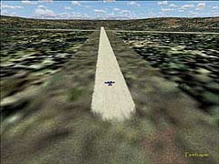
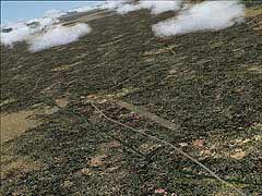
won't find this airfield listed in the airport listings within MSFS2004, but it does show on the map view.
As you can see, the terrain on this flight is extreme. If you're flying with realism settings set to max, don't forget to check your mixture and prop pitch.
This was a beautifully diverse flight! It also offers a great opportunity to practice your long range VFR, since there are some very prominent terrain features in this area.
Utilizing a flight simulator, such as MSFS 2004 embodies so much more than just zipping around, taking screenshots, or chasing your buddies all over the "virtual skies". It's an opportunity for those that would not otherwise be able to
Utilizing a flight simulator, such as MSFS 2004 embodies so much more than just zipping around, taking screenshots, or chasing your buddies all over the "virtual skies". It's an opportunity for those that would not otherwise be able to
explore these far away lands, and see the wonders that can be found, in every corner of the globe! So jump in, buckle up, and go exploring!