
Thanks For The Visit !


www.farmboyzimsflightsims.com
FBZFS
FBZ's Fast Flight's
The People's Republic of China
The People's Republic of China
The People’s Republic of China is another region that has not been explored in depth by your truly, so head to the hanger, get into your favorite ride, and prepare yourself for some surprises that await you in this vast country. What about restricted airspace? One of the great things about flight simulation is that we can visit restricted airspaces, and not have to worry about being escorted to the nearest airfield. Crossing over into no-man’s land is one of the many pleasures (yeah, I said “pleasure”) of the virtual world. I can’t think of many regions on the earth with a bigger restricted airspace than that of China. It does have its commercial flights coming and going; just don’t get caught joy-riding in their skies! China will be hosting the next Olympics, but since there are no events concerning aviation, we’ll fly right by that subject!
One of the first things I generally do when I start researching an article, is to do a search to see if there are any enhancements (freeware first of course!) out there for the region or country I will be exploring. Although MS did a fine job, there are loads of areas around the globe that required some more attention to detail, and China was certainly one of them! Chong Yun Ho has compiled a set of 18 zip files that contain 40 replacement .bgl files for all of China. Those are Terrain Mesh files for those that don’t know their .bgl from a hole in the ground! SRTM (Shuttle Radar Topography Mission) data from NASA was used. The file names are china_mesh.1.zip thru china_mesh.39.40.zip, and can be found at most major sim sites. Download times will
One of the first things I generally do when I start researching an article, is to do a search to see if there are any enhancements (freeware first of course!) out there for the region or country I will be exploring. Although MS did a fine job, there are loads of areas around the globe that required some more attention to detail, and China was certainly one of them! Chong Yun Ho has compiled a set of 18 zip files that contain 40 replacement .bgl files for all of China. Those are Terrain Mesh files for those that don’t know their .bgl from a hole in the ground! SRTM (Shuttle Radar Topography Mission) data from NASA was used. The file names are china_mesh.1.zip thru china_mesh.39.40.zip, and can be found at most major sim sites. Download times will
vary, but they are large files, so just kick back and grab a cup of coffee or hot chocolate, and download away. It is a fantastic improvement over the default terrain mesh of MSFS 2004 and I highly recommend these files.
The "Forbidden City"
Protected parking
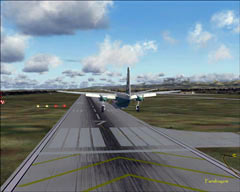
Taking off from the city of Xian, part of the "Silk Road"
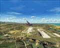
Quite a few of the airfields throughout the country are operated by the military. As a matter of fact, the majority of civil airline pilots are former military. Many additional airports have been constructed in China since Beijing’s first modern, civilian airport was built back in 1958. That airport was eventually replaced in 1980 by Capital Airport (ZBAA). A number of major airport projects have been completed since then, with modern facilities now serving Hong Kong (1998), Shanghai (2000), and other large cities. In FS, China seems to have been neglected a bit, both in the terrain features, and the amount of airports and airfields that one can utilize. It’s not too bad, but there was room for improvement, and that’s just what some folks did. In conjunction with the Terrain Mesh mentioned above, I used China Airports V2 (chinaairports_version_2.zip), by Winfried Dorthmann. Loads of airports and airfields added using a combination of sources for information. Some airfields have been arbitrarily named with a fictitious ICAO code where no information was available. Still, this is a great freeware addition for the virtual country of China. You will notice that at some of the Air Force bases there are built up revetments for the aircraft to park in. A very nice touch!
Exploring the virtual skies of China was a rather new experience for me. In the past, the only places that I have hopped out of had been Beijing and Hong Kong. For the past month now, I have been exploring the nooks and crannies of China, finding out once again, that I’ve been missing out on some beautiful areas to fly in. So, without taking up the entire magazine from cover to cover, I’m going to try to point the nose of your aircraft in the right (or left) direction, and show you just a little of what there is to see in this ancient and diverse land. After that, you are on your own! You can easily occupy hours in the skies of this land, perhaps following the Yangtze or the Yellow River, as they wind across China. Maybe you will want to fly the ancient route known as the “Silk Road”, retracing in the air, what traders of hundreds and even a thousand plus years ago had to travel by foot. Step back in time to a more recent era, and fly the legendary “Hump”, which supplied China during World War II. So let’s go and explore a country that to this day, remains a mystery to most of the world!
The Turfan Depression
"Silk Road" Terrain
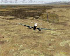
Typical "Hump" weather
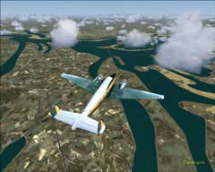
Cruising through the "Three Gorges" area
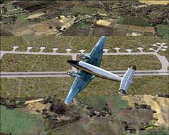
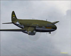
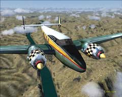
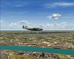
It would take a lot more time than I have to include all there is to see while flying the skies of China. So, let’s work our way around the country in sections. We’ll start off in the west, where most of you are already familiar with the stories of the “Hump”. Where China bumps up against what was then called Burma, now Myanmar, the “Hump” was a section of the Himalaya’s that pilots had to cross in order to get supplies to the Chinese during World War II. The main supply route, the Burma Road had been cut by the Japanese forces, so up over the mountains was the only choice at the time. The aircraft of choice was the Curtiss C-46, which was able to gain the necessary altitude to get over the mountains, plus it had more cargo space than the C-47, which was the backbone of military transport for many years. Holger Sandmann and Jonathan de Ferranti have compiled some fantastic Terrain Mesh packages that cover sections of the Himalaya’s. Well worth the time of downloading. The Curtiss C-46 I used was a GMAX version by Libardo Guzman, Greg Pepper, and Tom Gibson.
The western regions of China are great for the pilot that enjoys mountain flying. The route of the “Hump” was from India, over Burma, and on into Kunming, China. It is said that this area has the world’s worst weather…consistently! Some of the tales of flying in this weather are simply hair-raising! I don’t know about you, but for me, flying in the gray of the clouds in the simulator is confusing enough! These guys did it on a daily basis. If you are up for some historical, white-knuckle flying, re-enact this route. The airfield in India I used as a starting point was in Dibrugarh (VEMN) elevation 360 ft. I believe Chabua, India was one
The western regions of China are great for the pilot that enjoys mountain flying. The route of the “Hump” was from India, over Burma, and on into Kunming, China. It is said that this area has the world’s worst weather…consistently! Some of the tales of flying in this weather are simply hair-raising! I don’t know about you, but for me, flying in the gray of the clouds in the simulator is confusing enough! These guys did it on a daily basis. If you are up for some historical, white-knuckle flying, re-enact this route. The airfield in India I used as a starting point was in Dibrugarh (VEMN) elevation 360 ft. I believe Chabua, India was one
Curtiss C-46
of the original locations of operations, but it is not found in MSFS. Make a stop in Myitkyina, Myanmar (Burma), elevation 475 ft., stretch your legs, get some coffee, and get ready for the “Hump” leg of the journey! From here the going may get rough if you have the real world weather on, and the sun’s usually no where to be found! You will be climbing to over 10,000 plus feet in order to clear the tops of some very tall and cold mountains. Flying in this environment with little or no visibility can really wear on one’s nerves, and that’s an understatement if ever I heard one! Once you have cleared the mountain range and you are in the Chinese airspace, you’ll be looking for the airfield at Kunming (ZPPP), and some well deserved rest! This is a route that, if flown with real world weather, is probably more suited for the experienced simmer. Fly in good weather and you are in for a site seeing delight!
Heading north, up and over the Himalayan Plateau, we enter the land that contains the Tarim Basin. Are you ready to learn a new word? The Tarim Basin is one of the largest Endorheic Basins in the world. This is a closed drainage basin that retains runoff water from surrounding mountains or rains. One of the few rivers to cross the desert is the Tarim River, which ended not in the sea, but in the Lake Taitema. Due to poor water management, this lake dried up, part of what is called “desertification”. In the last few years, improved management has brought water back to the lake, as well as better farming to surrounding areas. The ancient “Silk Road” cut through this region. This was a trade route connecting Asia to Europe and dates back thousands of years. Retrace in the air, that which had taken traders of old, month’s or even year’s to complete. This route will take you over some very interesting terrain, and you’ll cross a few border’s as well.
Here's a few shots along the China portion of the route...
Here's a few shots along the China portion of the route...
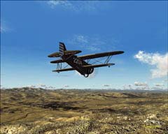
Curtiss Hawk III, on the "Silk Road"
Xian to Lanzhou leg.
Xian to Lanzhou leg.
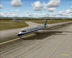
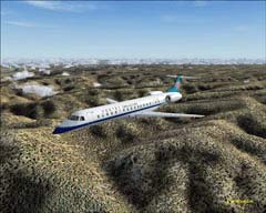
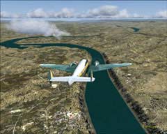
Embraer 145
Lanzhou to Xining leg.
Lanzhou to Xining leg.
Landing at Xining
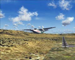
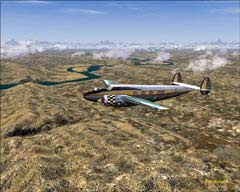
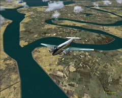
Aero Commander 560
Leaving Xining for Urumgi
Leaving Xining for Urumgi
Passing by the Turfan Depression,
an awesome site!
an awesome site!
Touching down at Urumgi.
Let’s head east now, towards the Gobi Desert. Here’s some more terrain that will definitely challenge your VFR flight skills! Meaning…there’s not too much in the way of terrain features! The Gobi, which means gravel covered plain, is a large desert region that is shared by both China and Mongolia. This desert is the fourth largest in the world, and the largest in Asia. Most of the Gobi is actually covered not by sand, but by gravel, hence the name. This vast desert is often associated with the Mongol Empire of days gone by. It also contained many important cities that were situated along the Silk Road, mentioned earlier.
The Gobi desert is created by the Himalayan Mountain Range blocking rain carrying clouds from reaching this area. Being located so far north, the Gobi is a cold desert, with frost often appearing on the dunes. It is also less than 3,000 feet in elevation, which helps to keep things cool. Only 7 to 8 inches of rainfall drops in on the Gobi per year. Any other moisture is picked up by the winds blowing snow off the Siberian Steppes. January temperatures can vary from -16 degrees to +2
The Gobi desert is created by the Himalayan Mountain Range blocking rain carrying clouds from reaching this area. Being located so far north, the Gobi is a cold desert, with frost often appearing on the dunes. It is also less than 3,000 feet in elevation, which helps to keep things cool. Only 7 to 8 inches of rainfall drops in on the Gobi per year. Any other moisture is picked up by the winds blowing snow off the Siberian Steppes. January temperatures can vary from -16 degrees to +2
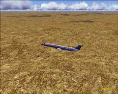
degrees Fahrenheit and July temperatures range in the low to high 60’s Fahrenheit. Extreme temps in the summer can reach the high 90’s with winter extremes in the -45 degree Fahrenheit range. This is not what you would typically think of when one imagines a desert. Crawling along sand dunes, gasping out the words “water, water” comes to my mind! Not digging out the winter parka and mittens!
A process known as “desertification” is taking place in the Gobi at an alarming rate. This is the expansion of the actual desert itself. More and more areas of grassland that border the Gobi are being used to raise livestock as people return to a more rural lifestyle, due to the economy. These lands are being over used and trampled, both by livestock and people. Approximately 1.500 square miles of grassland per year is chewed up by the Gobi. This desertification is more rapid in the southern areas of the Gobi. Some efforts have been implemented to stop the spread of the desert, but most have only met with a small degree of success at best. China’s most recent plan is to plant the “Green Wall of China”. This would be a ring of forest planted around the Gobi in an effort to stop its spread. I wish them all the luck in the world in this monumental task!
A process known as “desertification” is taking place in the Gobi at an alarming rate. This is the expansion of the actual desert itself. More and more areas of grassland that border the Gobi are being used to raise livestock as people return to a more rural lifestyle, due to the economy. These lands are being over used and trampled, both by livestock and people. Approximately 1.500 square miles of grassland per year is chewed up by the Gobi. This desertification is more rapid in the southern areas of the Gobi. Some efforts have been implemented to stop the spread of the desert, but most have only met with a small degree of success at best. China’s most recent plan is to plant the “Green Wall of China”. This would be a ring of forest planted around the Gobi in an effort to stop its spread. I wish them all the luck in the world in this monumental task!
Touching down at Urumgi.
Touching down at Urumgi.
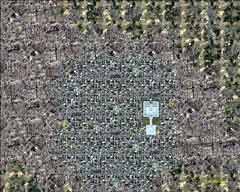
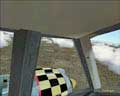
This has got to be considered
"Restricted Airspace" !
"Restricted Airspace" !
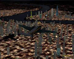
Top down view of Beijing.
The "Forbidden City" easily seen.
The "Forbidden City" easily seen.
While we are up in this neck of the woods (no pun intended!), let’s drop in on the capital of China, Beijing, which is located in the northwestern part of the country. Situated in between the Inner Mongolian Plateau and the North China Plains, the area offers hours, if not days, of flying fun and adventure. The region does not have the rugged mountains that you would find out in western China, but the terrain is varied as you find your way north towards the Gobi. The terrain in this area offers up loads of gentle, rolling hills, which continue on into the Gobi. North of Beijing, the Great Wall of China runs east to west, but this is not represented in MSFS. Scenery Developer alert!
The first modern, civilian airport was built back in 1958, which was eventually replaced in 1980 by Beijing’s Capital Airport (ZBAA). Beijing has gone through some growth spurts since the economic reforms of 1979 took hold. Once surrounded by agricultural and forested lands, the capital city is spreading out in all directions, using up agricultural and forested land. As of the year 2000, the population of Beijing was over 13 million.
The first modern, civilian airport was built back in 1958, which was eventually replaced in 1980 by Beijing’s Capital Airport (ZBAA). Beijing has gone through some growth spurts since the economic reforms of 1979 took hold. Once surrounded by agricultural and forested lands, the capital city is spreading out in all directions, using up agricultural and forested land. As of the year 2000, the population of Beijing was over 13 million.
North east of Beijing is the industrial city of Shenyang, which is worth a quick mention. Home of the Shenyang Aircraft Corporation, it is one of the oldest and the most important aircraft manufacturers in China. It was founded back in 1953. Recently, the Shenyang Aircraft Corporation have entered into talks with Cessna over work on one of Cessna’s new sport aircraft, the C162. They have been primarily a military developer, with some experience in General Aviation aircraft.
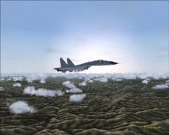
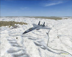
The Su-27
A product of Shenyang
A product of Shenyang
Su-27 in a colder climate of China
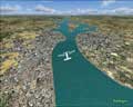
The next stop on our whirlwind tour of China is a spot that I find myself returning to time and time again, Chongqing. Chongqing is located in the southeastern section of the Sichuan Basin where the Yangtze and Jialing rivers meet, in southwestern China. This city was established over 3,000 years ago. Known for its beautiful mountains and rivers, it is also known as the “City of Fog”. Keep this in mind all you VFR pilots out there. The Yangtze River cuts through hills and mountain ranges and if you continue east on the river, you will pass through an area called the “Three Gorges”. This area runs on for about 120 miles and is the home of the Three Gorges International Travel Festival, which runs from May to June every year. There are also a number of cruise ships that sail the Yangtze offering anything from day trips to extended vacation cruises. After all, this is one very long river, and there is quite a lot to see along the way.
One of the modern engineering marvels of our time is being constructed on the Yangtze River, and that is the Three Gorges Dam. This is one of the largest construction projects on the planet, and will hopefully supply over one-ninth of China’s electricity. This is equal to about 15 nuclear power plants, to give you an idea of the immensity of the project. This dam will also help to control the flooding that occurs along the Yangtze, which has been the cause of over one million deaths over the last century. There is a negative side to this coin though and that is the fact that surrounding land and some villages will be swallowed up by the water. I suppose this is one of those “give-or-take” situations. The dam itself is not represented in MSFS, so, another heads up out there to all you scenery developers! You can follow the Yangtze all the way across the country of China, experiencing some great virtual flying along the way.
Chongqing at night
East over the Yangtze
The Yangtze River in the background
The Howard 500
Another “Super Highway” of rivers, the Yellow River runs east to west in the northern realms of the country of China. It winds up and around the lower edge of the Gobi Desert, back down into the area that was the birthplace of China, Changing, and then east to finally empty into the sea. The Yellow River is the muddiest river in the world, and is so named because of the yellowish mud and sentiment that it picks up and carries on its way to sea. This river also provides a wealth of virtual flying pleasures as you follow it on its winding path across the country. MSFS does not really reflect the yellowish color of the river, but they do a great job rendering the waterways of China in general. Once you fly along these rivers, you will see just how important they were in the development of the country, and how they tied the regions together.
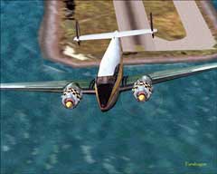
Hong Kong, located on the eastern coast of China, is our next stop. Most will know that Hong Kong was part of the British colonies up until 1999, when the “lease” ran out, and China did not want to “renew” said lease. The history of Hong Kong is lengthy, so you are on your own if you want a history lessen! The Hong Kong International Airport (VHHH) is located on an artificial island and opened for commercial operations in 1998, serving both tourism and commerce. The airports location in Asia has made it an important regional trans-shipment center, passenger hub and gateway to other Chinese cities. The airport operates around-the-clock and is capable of handling 45 million passengers and three million tons of cargo a year. With the opening of the second runway in May of 1999, the airport has been further developed in stages to cater for increasing air traffic demand. At its ultimate design development, the airport will be able to handle up to 87 million passengers and nine million tons of cargo annually. It’s an excellent spot to take off from to explore the eastern coast of China.
Exploring the city of Hong Kong itself and its surrounding area is a bit of a treat as well, especially at night. The old airport, Kai Tak International (VHHX), appears in MSFS2004, to be closed down, as in real life. There are “X’s” at either end of its only runway, 13/31. That, of course, did not stop yours truly from dropping in for a visit! Once again, no permits needed! With only one runway, Kai Tak was well known for its difficult landing and take off requirements. Buildings and mountains proved to be formidable obstacles when operating in or out of Kai Tak. The approach to 13 would take you over the harbor and low over
Exploring the city of Hong Kong itself and its surrounding area is a bit of a treat as well, especially at night. The old airport, Kai Tak International (VHHX), appears in MSFS2004, to be closed down, as in real life. There are “X’s” at either end of its only runway, 13/31. That, of course, did not stop yours truly from dropping in for a visit! Once again, no permits needed! With only one runway, Kai Tak was well known for its difficult landing and take off requirements. Buildings and mountains proved to be formidable obstacles when operating in or out of Kai Tak. The approach to 13 would take you over the harbor and low over
The (not so) Yellow River
Forgot to bring the floats along!
western Kowloon, which is heavily populated. Visual approaches were the order of the day as well when utilizing RW 13, and was closed down under low visibility conditions. There were no ILS approaches for RW 13, but RW 31 did have this accommodation, and isn’t as much of a challenge as RW 13 was.
Heading out of the old
Hong Kong Intl. VHHX
Hong Kong Intl. VHHX
The new Hong Kong Intl., VHHH on the artificial island
I do know what the "X" at the end of the runway means!
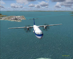
ATR 72-500 over Hong Kong
VHHH on the left, VHHX on the right
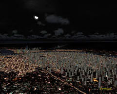
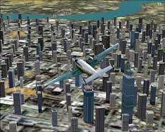
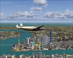
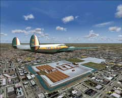
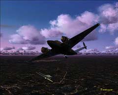
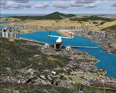
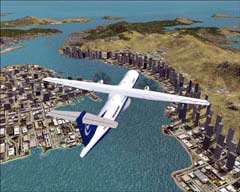
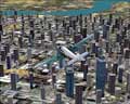
What’s a visit to China without a stop at Shanghai? Incomplete, that’s what! Here is a sprawling city on the east coast of China, situated on the banks of the Yangtze River. Shanghai is the largest city in the People’s Republic of China, and the tenth largest in the world. It became the largest cargo port for ships in the world back in 2005. You may have heard of the term “shanghaied”. This refers to the practice of tricking or otherwise fooling one into duty aboard a ship. This was, for the most part, forced labor, and the term itself comes from the fact that some of the old clipper ships of that era had the destination of Shanghai. So the name stuck. It is a beautiful city, especially at night, but it is also a city not without its problems. Heavy worker migration and environmental degradation is the price that has been paid for growth.
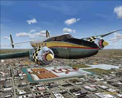
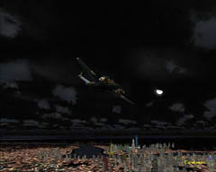
Night flight for the Howard 500
I'd like to own stock in the Power Company there!
This had to take some time to build..
for the sim and in real life!
for the sim and in real life!
Wonderful site-seeing along the river!
Buildings are nicely detailed
Shanghai skyline
A very busy place!
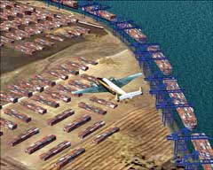
Beautiful detail of the Shanghai harbors
It would be impossible to cover all that there is to see in just one article, but I do believe this is a good start! China is a very large country, and I’m sure you’ll find loads of other things to feast your eyes on while exploring, and that’s what it’s all about!
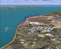
I already mentioned the terrific terrain mesh that enhances the land of China, along with the package that adds additional, and much needed airports and fields throughout China. One other very notable scenery package is that of the city Shanghai. This little gem was put together by Nestor D'Angelo and features literally hundreds of buildings in and around Shanghai, in what he states are a fairly accurate representation. If you take a flight out of Pudong (KSPD), which is one of many districts in Shanghai, and fly north, you will find cargo docks and storage tanks, as well as a few container ships coming in to port. This is also a vast improvement over the default autogen (buildings, etc.) you’ll find for Shanghai. Excellent night textures are included as well. Certainly a must have file for those wishing to get the most out of flying in China. You’ll find this scenery under the file name of shang071.zip. There was one obvious omission that I had looked for in the virtual lands of China, and that is the Great Wall. I do realize that it would probably be a monumental task developing this scenery, but not as difficult as the real thing! I was surprised to not find even a small section of the wall rendered. Freeware Scenery developers, take note! It’s “wish list” time!
As for the aircraft that I flew for this article, there were many! Various conditions and flight routes dictated the use of a fully stocked hanger! Here’s a quick list…
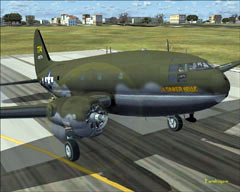
Dreamwings Embraer 135 and 14X series (csnb3060.zip).
Re-paint and model of Robert Hawk’s P 40 for Flight Simulator 2004. Textures are by Mark ‘Fireball ‘Rooks. (rsdgtex.zip).
The Su-27B/UB/Su-30MKK Package by Bill Wolfgen (su27flch.zip).
CFS2/ FS2004 Curtiss Hawk III model 68C - CAF Aces 1937 Version 3.0
Model comes with 6 liveries by Ivan Hsu. Included also is an excellent history text (hawk3v3.zip).
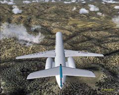
China Xinjiang Airlines ATR-72-500 utilizing Francisco Sįnchez's ATR 72 model (atr72xin.zip).
Curtiss C-46 Commando by Libardo Guzman, Greg Pepper, and Tom Gibson (c46ga.zip), (c46gafix.zip), and the USAAF livery “The Tinker Belle” (46ga_tin.zip).
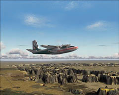
The Aero Commander 560 by Milton Shupe, Scott Thomas and André Folkers, (ac560vc9.zip), and the Howard 500 (hw5cfgup.zip) by Milton Shupe, Scott Thomas, and Joįo Paz. These two aircraft have nothing to do with China…they’re just fun to fly and get around well!
Yes, this is quite a large list of aircraft, but then, China is a large country! These are very fine additions for the virtual hanger, and many hours are spent in their creation, so I like to give as much credit as I can! Loads of other fine models and liveries with reference to China can be found on the major sim sites as well.
Some of these models require permission to upload to sites, so just do a search for those zip files and you should find them with no problem! The zipfiles that have links are OK to download from here at Farmboyzim's! Thanks all you Freeware Developers out there! As you know, we appreciate it!
Thanks to the folks over at Flight1 for providing me with Flight Environment and Ground Environment Pro to make my virtual world a more pleasant place to visit!
I hope you enjoyed this article about flying the virtual skies of China! I’m certain that you will be able to spend many hours exploring this vast and ancient land! Have a great flight, and remember that wherever we are, we have to take care of this aircraft called Earth!!
I already mentioned the terrific terrain mesh that enhances the land of China, along with the package that adds additional, and much needed airports and fields throughout China. One other very notable scenery package is that of the city Shanghai. This little gem was put together by Nestor D'Angelo and features literally hundreds of buildings in and around Shanghai, in what he states are a fairly accurate representation. If you take a flight out of Pudong (KSPD), which is one of many districts in Shanghai, and fly north, you will find cargo docks and storage tanks, as well as a few container ships coming in to port. This is also a vast improvement over the default autogen (buildings, etc.) you’ll find for Shanghai. Excellent night textures are included as well. Certainly a must have file for those wishing to get the most out of flying in China. You’ll find this scenery under the file name of shang071.zip. There was one obvious omission that I had looked for in the virtual lands of China, and that is the Great Wall. I do realize that it would probably be a monumental task developing this scenery, but not as difficult as the real thing! I was surprised to not find even a small section of the wall rendered. Freeware Scenery developers, take note! It’s “wish list” time!
As for the aircraft that I flew for this article, there were many! Various conditions and flight routes dictated the use of a fully stocked hanger! Here’s a quick list…
Dreamwings Embraer 135 and 14X series (csnb3060.zip).
Re-paint and model of Robert Hawk’s P 40 for Flight Simulator 2004. Textures are by Mark ‘Fireball ‘Rooks. (rsdgtex.zip).
The Su-27B/UB/Su-30MKK Package by Bill Wolfgen (su27flch.zip).
CFS2/ FS2004 Curtiss Hawk III model 68C - CAF Aces 1937 Version 3.0
Model comes with 6 liveries by Ivan Hsu. Included also is an excellent history text (hawk3v3.zip).
China Xinjiang Airlines ATR-72-500 utilizing Francisco Sįnchez's ATR 72 model (atr72xin.zip).
Curtiss C-46 Commando by Libardo Guzman, Greg Pepper, and Tom Gibson (c46ga.zip), (c46gafix.zip), and the USAAF livery “The Tinker Belle” (46ga_tin.zip).
The Aero Commander 560 by Milton Shupe, Scott Thomas and André Folkers, (ac560vc9.zip), and the Howard 500 (hw5cfgup.zip) by Milton Shupe, Scott Thomas, and Joįo Paz. These two aircraft have nothing to do with China…they’re just fun to fly and get around well!
Yes, this is quite a large list of aircraft, but then, China is a large country! These are very fine additions for the virtual hanger, and many hours are spent in their creation, so I like to give as much credit as I can! Loads of other fine models and liveries with reference to China can be found on the major sim sites as well.
Some of these models require permission to upload to sites, so just do a search for those zip files and you should find them with no problem! The zipfiles that have links are OK to download from here at Farmboyzim's! Thanks all you Freeware Developers out there! As you know, we appreciate it!
Thanks to the folks over at Flight1 for providing me with Flight Environment and Ground Environment Pro to make my virtual world a more pleasant place to visit!
I hope you enjoyed this article about flying the virtual skies of China! I’m certain that you will be able to spend many hours exploring this vast and ancient land! Have a great flight, and remember that wherever we are, we have to take care of this aircraft called Earth!!
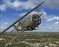
Curtiss Hawk III
China on the left, North Korea on the right
The Great Wall is nowhere to be found
Chiang Kai Shek Airport
Crowded in Shang Hai